Heidehöhe
From The Right Wiki
You can help expand this article with text translated from the corresponding article in Deutsch. (June 2010) Click [show] for important translation instructions.
|
| Heidehöhe | |
|---|---|
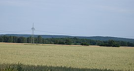
 The Heidehöhe seen from the north | |
| Highest point | |
| Elevation | 201.4 m (661 ft) |
| Geography | |
| Location | Brandenburg, |
The Heidehöhe is a hill, 201.4 metres high, and the highest point in the state of Brandenburg, Germany. Its actual summit, known as the Heideberg, lies over the border in the state of Saxony and reaches a height of 206.1 metres.