Flor do Prado River
From The Right Wiki
| Flor do Prado River | |
|---|---|
| Native name | Rio Flor do Prado (Portuguese) |
| Location | |
| Country | Brazil |
| Physical characteristics | |
| Mouth | |
• location | Roosevelt River, Aripuanã, Mato Grosso |
• coordinates | 10°42′47″S 60°26′47″W / 10.713075°S 60.446436°W |
| Basin features | |
| River system | Roosevelt River |
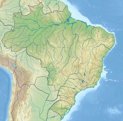
The Flor do Prado River is a river in the state of Mato Grosso in Brazil, a right tributary of the Roosevelt River. The 8,517 hectares (21,050 acres) Rio Flor do Prado Ecological Station, a fully protected environmental unit created in 2003, lies on the right bank of the river.[1]
See also
References
- ↑ Blairo Borges Maggi (9 December 2003), Decreto 2.124 de 09 de Dezembro de 2003 (in Portuguese), archived from the original on 2016-08-21, retrieved 2016-06-05
{{citation}}: CS1 maint: unrecognized language (link)
