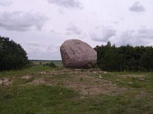
Juozapinė Hill
From The Right Wiki
This article needs additional citations for verification. (October 2023) |

Juozapinė Hill is a hill located near Vilnius. It was formerly believed to be highest point in Lithuania.[1] However, in 2007 the peaks were remeasured by staff at Vilnius Gediminas Technical University, using GPS technology. They found its elevation to be 292.7 metres (957 feet). The actual highest point in Lithuania is the nearby Aukštojas Hill (293.84 m). Juozapinė Hill is in fact only the third highest elevation in Lithuania, the second being Kruopinė (Žybartonys) Hill (293.65 m) situated approximately 10 km west of Juozapinė Hill. Juozapinė Hill has a monument to King Mindaugas at the top.
See also
- Aukštojas Hill, the actual highest point in Lithuania
- Kruopinė Hill, also formerly stated to be the highest point
References
- ↑ Disease and Environmental Alert Reports (DEAR). U.S. Armed Forces Medical Intelligence Center. Epidemiology and Environmental Health Division. 1996. p. 1.
External links
- (in Lithuanian) Which are the highest hills in Lithuania? (in Lithuanian) - a note by Rimantas Krupickas, a Lithuanian geographer, on the recent measurements of the highest elevations in Lithuania