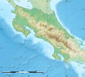
Cañas River Lacustrine Wetland
From The Right Wiki
Jump to navigationJump to search
| Cañas River Lacustrine Wetland | |
|---|---|
| Humedal Lacustrino Rio Cañas | |
| Location | Costa Rica |
| Coordinates | 10°20′02″N 85°36′50″W / 10.334°N 85.614°W |
| Area | 6.56 square kilometres (2.53 sq mi) |
| Established | 7 April 1994 |
| Governing body | National System of Conservation Areas (SINAC) |
Cañas River Lacustrine Wetland (Spanish: Humedal Lacustrino Rio Cañas), is a protected area in Costa Rica, managed under the Tempisque Conservation Area, it was created in 1994 by decree 23075-MIRENEM.[1][2]
References
- ↑ "Humedal Lacustrino Rio Cañas Map". SINAC. Retrieved 6 May 2020.
- ↑ "Humedal Lacustrino Rio Cañas". Protected Planet. Retrieved 6 May 2020.
