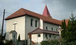
Nowy Świętów
Nowy Świętów | |
|---|---|
Village | |
 Christ the King church in Nowy Świętów | |
Nowy Świętów is located in Poland Nowy Świętów | |
| Coordinates: 50°22′25″N 17°21′36″E / 50.37361°N 17.36000°E | |
| Country | File:Flag of Poland.svg Poland |
| Voivodeship | Opole |
| County | Nysa |
| Gmina | Głuchołazy |
| First mentioned | 1300 |
| Highest elevation | 255 m (837 ft) |
| Lowest elevation | 252 m (827 ft) |
| Population | 1,000 |
| Time zone | UTC+1 (CET) |
| • Summer (DST) | UTC+2 (CEST) |
| Vehicle registration | ONY |
| Voivodeship roads | File:DW411-PL.svg |
Nowy Świętów (Polish: [ˈnɔvɨ ˈɕfjɛntuf]) is a village in the administrative district of Gmina Głuchołazy, within Nysa County, Opole Voivodeship, in south-western Poland, close to the Czech border.[1] It lies approximately 7 kilometres (4 mi) north of Głuchołazy, 12 km (7 mi) south of Nysa, and 52 km (32 mi) south-west of the regional capital Opole.
History
The village was first mentioned in 1300, when it was part of fragmented Piast-ruled Poland. Later on, it was also part of Bohemia (Czechia), Prussia, and Germany. During World War II, the Germans operated the E477 forced labour subcamp of the Stalag VIII-B/344 prisoner-of-war camp in the village.[2] After Germany's defeat in the war, in 1945, the village became again part of Poland.
Transport
There is a train station in Nowy Świętów, and the Voivodeship road 411 also passes through the village.
References
- ↑ "Central Statistical Office (GUS) - TERYT (National Register of Territorial Land Apportionment Journal)" (in Polish). 2008-06-01.
{{cite web}}: CS1 maint: unrecognized language (link) - ↑ "Working Parties". Lamsdorf.com. Archived from the original on 29 October 2020. Retrieved 11 November 2021.